
Saved Download on the App Store
← Back to launches
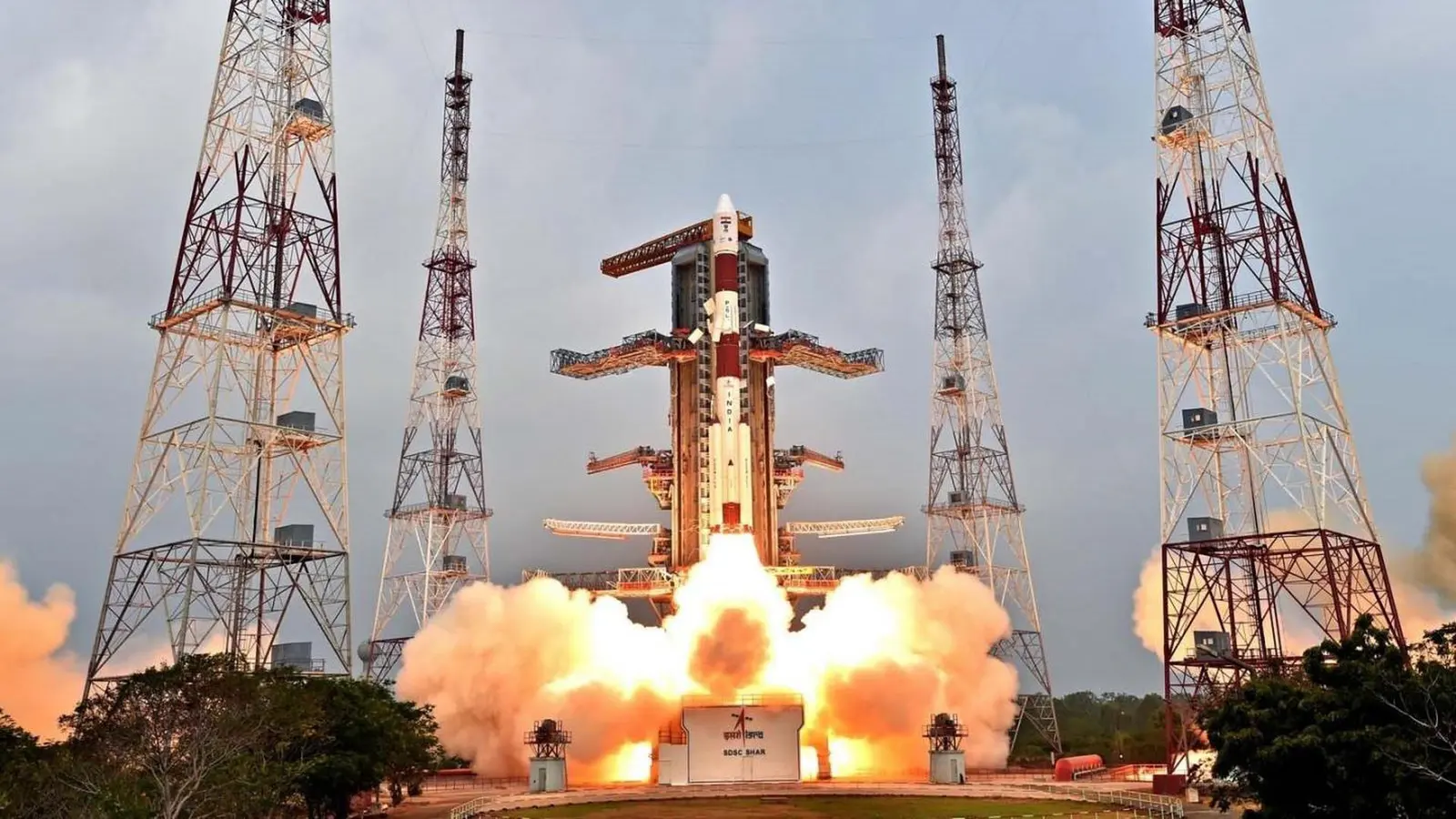
PSLV XL | IRNSS-1F
Indian Space Research OrganizationLaunch Successful

IRNSS-1F

PSLV XL

Historical mission record

This page records PSLV XL | IRNSS-1F and its reported outcome: Launch Successful. The date above is a historical record.

Source record updated . This is a source update, not a confirmed launch time.

Check the source: Launch Library ↗

How to read launch targets and status

Mission status
Launch Successful

Status reported by the mission data provider.

LAUNCH SITESatish Dhawan Space Centre, India

Mission

This is the 6th satellite out of 7 for the Indian Regional Navigation Satellite System. The constellation will provide India with an alternative to GPS and will be used for military and civilian use. Located at a geosynchronous orbit the system will be operated by the Indian government.

Launch vehicle
PSLV XL
Mission type
Navigation
Destination orbit
Geostationary Transfer Orbit
Launch pad
Satish Dhawan Space Centre First Launch Pad
Provider
Indian Space Research Organization

The vehicle

Published configuration and flight history.

PSLV XL
Launch vehicle

PSLV XL

PSLV-XL is the upgraded version of Polar Satellite Launch Vehicle in its standard configuration boosted by more powerful, stretched strap-on boosters with 12 tonne propellant load. Weighing 320t at lift-off, the vehicle uses larger strap-on motors (PSOM-XL or S12) to achieve higher payload capability. On 29 December 2005, ISRO successfully tested the improved version of strap-on booster for the PSLV. The first use of PSLV-XL was the launch of Chandrayaan-1 by PSLV C11. The payload capability for this variant is 1,800 kg to SSO.

Height
44 m
Diameter
2.8 m
Stages
4
Recorded launches
27
First flight
2008-10-22

Recorded timing

This is a mission record, not an upcoming calendar appointment.

Instantaneous windowPublished target
SCHEDULED MOMENT

A single scheduled moment. The schedule may change before launch.

Launch site & orbit

Satish Dhawan Space Centre, India

The mission in perspective

Launch site & orbit

Explore the launch pad, then pull back to see the shape of the destination orbit.

Understand this orbit
NASA Blue Marble map of Earth's continents and oceans
Representative orbit · accelerated illustrationNo live tracking or simulated ascent. NASA Blue Marble.

Coverage & sources

Links supplied by the mission data provider.
Coverage and times may change.

Explore on iPhone

Browse mission details and discover upcoming launches in Spacian.

Open mission in Spacian ↗
Download on the App Store
