
Saved Download on the App Store
← Back to launches
Titan IIIC | LES 8, 9 & Solrad 11A, 11B
United States Air ForceLaunch Successful

LES 8, 9 & Solrad 11A, 11B

Titan IIIC

Open watch mode ↗

Historical mission record

This page records Titan IIIC | LES 8, 9 & Solrad 11A, 11B and its reported outcome: Launch Successful. The date above is a historical record.

Source record updated . This is a source update, not a confirmed launch time.

Check the source: Launch Library ↗

How to read launch targets and status

Mission status
Launch Successful

Status reported by the mission data provider.

LAUNCH SITECape Canaveral SFS, FL, USA

Mission

LES 8 and 9 were experimental nuclear-powered geostationary communications satellites. Solrad 11A and 11B were scientific satellites designed to monitor the solar X-ray, UV and energetic particle emissions.

Launch vehicle
Titan IIIC
Mission type
Dedicated Rideshare
Destination orbit
Geostationary Orbit
Launch pad
Space Launch Complex 40
Provider
United States Air Force

The vehicle

Published configuration and flight history.

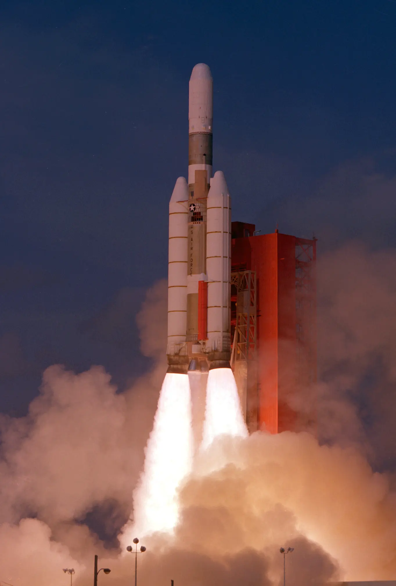
Titan IIIC
U.S. DoD
Launch vehicle

Titan IIIC

The Titan IIIC was an expendable launch system used by the United States Air Force from 1965 until 1982. It was the first Titan booster to feature large solid rocket motors and was planned to be used as a launcher for the Dyna-Soar, though the spaceplane was cancelled before it could fly. The majority of the launcher's payloads were DoD satellites, for military communications and early warning, though one flight (ATS-6) was performed by NASA. The Titan IIIC was launched exclusively from Cape Canaveral while its sibling, the Titan IIID, was launched only from Vandenberg AFB.

Height
42 m
Diameter
3 m
Stages
3
Recorded launches
36
First flight
1965-06-18

Recorded timing

This is a mission record, not an upcoming calendar appointment.

Instantaneous windowPublished target
SCHEDULED MOMENT

A single scheduled moment. The schedule may change before launch.

Launch site & orbit

Cape Canaveral SFS, FL, USA

The mission in perspective

Launch site & orbit

Explore the launch pad, then pull back to see the shape of the destination orbit.

Understand this orbit
NASA Blue Marble map of Earth's continents and oceans
Representative orbit · accelerated illustrationNo live tracking or simulated ascent. NASA Blue Marble.

Coverage & sources

Links supplied by the mission data provider.
Coverage and times may change.

Mission coverage

No viewing link has been published yet.

Further reading

Launch Library ↗

Explore on iPhone

Browse mission details and discover upcoming launches in Spacian.

Open mission in Spacian ↗
Download on the App Store
