
Saved Download on the App Store
← Back to launches
Ariane 5 ECA | Echostar 18 & BRIsat
ArianespaceLaunch Successful

Echostar 18 & BRIsat

Ariane 5 ECA

Historical mission record

This page records Ariane 5 ECA | Echostar 18 & BRIsat and its reported outcome: Launch Successful. The date above is a historical record.

Source record updated . This is a source update, not a confirmed launch time.

Check the source: Ariane 5 arrives at the Spaceport for a June launch with EchoStar XVIII and BRIsat ↗ · Launch Library ↗

How to read launch targets and status

Mission status
Launch Successful

Status reported by the mission data provider.

LAUNCH SITEGuiana Space Centre, French Guiana

Mission

Both Echostar-18 and BRISat are built by Space Systems/Loral using their 1300 bus to provide communications at geostationary orbit for 15 years. Echostar-18 will be positioned at 110 degrees west to replace Echostar-10, whereas BRISat will be stationed at 150 degrees east. BRISat will provide exclusive coverage for the Indonesian bank BRI which has 9,800 branches serving 50 million customers across the Indonesian archipelago. Echostar-18 and BRISat weigh 6000kg and 3500kg respectively.

Launch vehicle
Ariane 5 ECA
Mission type
Communications
Destination orbit
Geostationary Transfer Orbit
Launch pad
Ariane Launch Area 3
Provider
Arianespace

The vehicle

Published configuration and flight history.

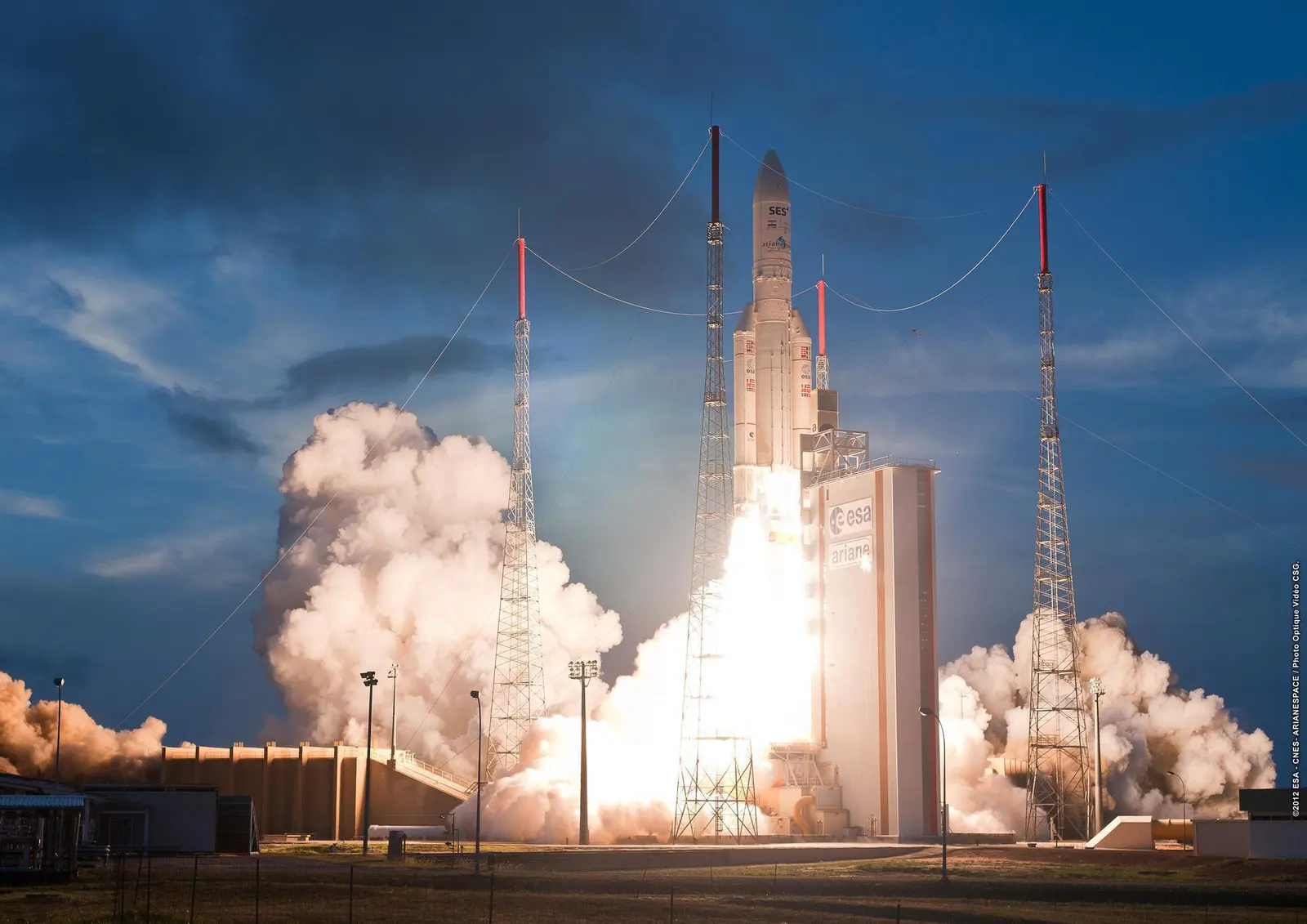
Ariane 5 ECA
ESA/CNES/Arianespace/Optique vidéo du CSG
Launch vehicle

Ariane 5 ECA

Ariane 5 is a heavy-lift launch vehicle, part of the Ariane rocket family.

Height
57.7 m
Diameter
5.4 m
Stages
2
Recorded launches
73
First flight
2002-12-11

Recorded timing

This is a mission record, not an upcoming calendar appointment.

1h 10m windowPublished target
WINDOW OPENS
WINDOW CLOSES

Target ·

The target marker shows its position within the published window. The schedule may change before launch.

Launch site & orbit

Guiana Space Centre, French Guiana

The mission in perspective

Launch site & orbit

Explore the launch pad, then pull back to see the shape of the destination orbit.

Understand this orbit
NASA Blue Marble map of Earth's continents and oceans
Representative orbit · accelerated illustrationNo live tracking or simulated ascent. NASA Blue Marble.

Coverage & sources

Links supplied by the mission data provider.
Coverage and times may change.

Explore on iPhone

Browse mission details and discover upcoming launches in Spacian.

Open mission in Spacian ↗
Download on the App Store
