
Saved Download on the App Store
← Back to launches
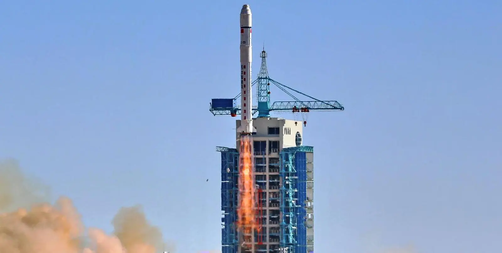
Long March 2D | VRSS-2 (Antonio José de Sucre)
China Aerospace Science and Technology CorporationLaunch Successful

VRSS-2 (Antonio José de Sucre)

Long March 2D

Historical mission record

This page records Long March 2D | VRSS-2 (Antonio José de Sucre) and its reported outcome: Launch Successful. The date above is a historical record.

Source record updated . This is a source update, not a confirmed launch time.

Check the source: Launch Library ↗

How to read launch targets and status

Mission status
Launch Successful

Status reported by the mission data provider.

LAUNCH SITEJiuquan Satellite Launch Center, People's Republic of China

Mission

VRSS-2 is the second Venezuelan remote sensing satellite. Spacecraft was built by China. Weighing about 1000 kg, it is to operate in sun-synchronous orbit at an altitude of 645 kilometres, providing services in traffic management, disaster warning and prevention, tracking agriculture and land use.

Launch vehicle
Long March 2D
Mission type
Earth Science
Destination orbit
Sun-Synchronous Orbit
Launch pad
Launch Area 94 (SLS-2 / 603)
Provider
China Aerospace Science and Technology Corporation

The vehicle

Published configuration and flight history.

Long March 2D
Launch vehicle

Long March 2D

The Long March 2D, also known as the Chang Zheng 2D, CZ-2D and LM-2D, is a Chinese orbital carrier rocket. It is a 2-stage carrier rocket mainly used for launching LEO and SSO satellites.

Height
38.3 m
Diameter
3.35 m
Stages
2
Recorded launches
96
First flight
1992-08-09

Recorded timing

This is a mission record, not an upcoming calendar appointment.

21 minute windowPublished target
WINDOW OPENS
WINDOW CLOSES

Target ·

The target marker shows its position within the published window. The schedule may change before launch.

Launch site & orbit

Jiuquan Satellite Launch Center, People's Republic of China

The mission in perspective

Launch site & orbit

Explore the launch pad, then pull back to see the shape of the destination orbit.

Understand this orbit
NASA Blue Marble map of Earth's continents and oceans
Representative orbit · accelerated illustrationNo live tracking or simulated ascent. NASA Blue Marble.

Coverage & sources

Links supplied by the mission data provider.
Coverage and times may change.

Explore on iPhone

Browse mission details and discover upcoming launches in Spacian.

Open mission in Spacian ↗
Download on the App Store
