
Saved Download on the App Store
← Back to launches
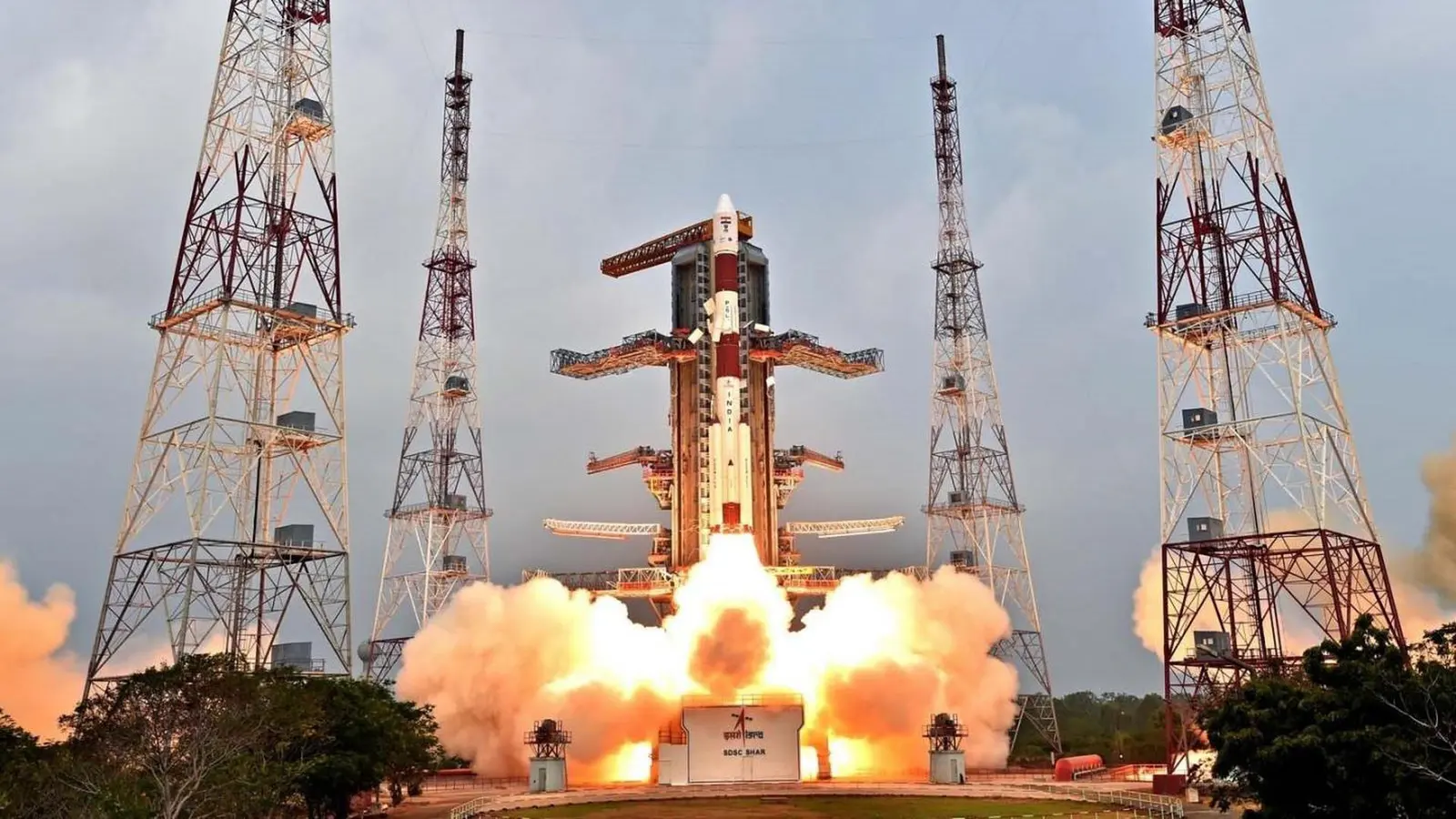
PSLV XL | Cartosat-2E
Indian Space Research OrganizationLaunch Successful

Cartosat-2E

PSLV XL

Historical mission record

This page records PSLV XL | Cartosat-2E and its reported outcome: Launch Successful. The date above is a historical record.

Source record updated . This is a source update, not a confirmed launch time.

Check the source: Launch Library ↗

How to read launch targets and status

Mission status
Launch Successful

Status reported by the mission data provider.

LAUNCH SITESatish Dhawan Space Centre, India

Mission

Cartosat-2E is seventh of Cartosat series of Earth observation satellites to be deployed in 500 km sun-synchronous orbit. Its main purpose is to collect high resolution large-scale maps which will be used for urban planning, infrastructure development, utilities planning and traffic management.

Launch vehicle
PSLV XL
Mission type
Earth Science
Destination orbit
Sun-Synchronous Orbit
Launch pad
Satish Dhawan Space Centre First Launch Pad
Provider
Indian Space Research Organization

The vehicle

Published configuration and flight history.

PSLV XL
Launch vehicle

PSLV XL

PSLV-XL is the upgraded version of Polar Satellite Launch Vehicle in its standard configuration boosted by more powerful, stretched strap-on boosters with 12 tonne propellant load. Weighing 320t at lift-off, the vehicle uses larger strap-on motors (PSOM-XL or S12) to achieve higher payload capability. On 29 December 2005, ISRO successfully tested the improved version of strap-on booster for the PSLV. The first use of PSLV-XL was the launch of Chandrayaan-1 by PSLV C11. The payload capability for this variant is 1,800 kg to SSO.

Height
44 m
Diameter
2.8 m
Stages
4
Recorded launches
27
First flight
2008-10-22

Recorded timing

This is a mission record, not an upcoming calendar appointment.

4h windowPublished target
WINDOW OPENS
WINDOW CLOSES

Target ·

The target marker shows its position within the published window. The schedule may change before launch.

Launch site & orbit

Satish Dhawan Space Centre, India

The mission in perspective

Launch site & orbit

Explore the launch pad, then pull back to see the shape of the destination orbit.

Understand this orbit
NASA Blue Marble map of Earth's continents and oceans
Representative orbit · accelerated illustrationNo live tracking or simulated ascent. NASA Blue Marble.

Coverage & sources

Links supplied by the mission data provider.
Coverage and times may change.

Explore on iPhone

Browse mission details and discover upcoming launches in Spacian.

Open mission in Spacian ↗
Download on the App Store
