

Reading the layers of Caloris
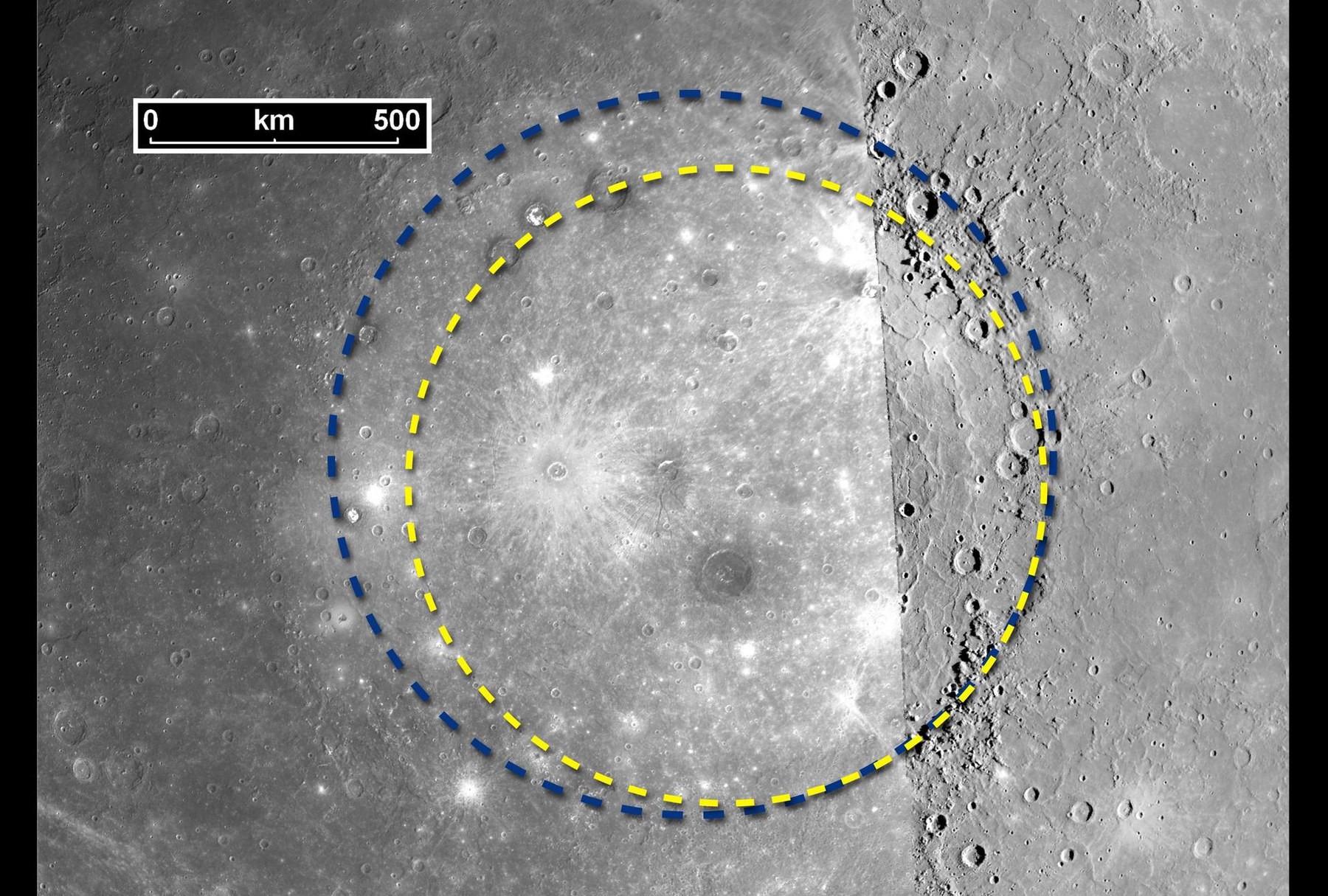
MESSENGER revealed the full extent of Caloris, a basin about 1,550 kilometres across. Its photographs do more than show a large crater: they let geologists reconstruct a sequence in which impact, volcanism and later bombardment changed the same ground.
Start with the biggest structure
Caloris formed when a large impactor struck Mercury. The basin’s rim and surrounding terrain preserve the large-scale disturbance. Mariner 10 had photographed only part of it; MESSENGER’s more complete views showed a structure larger than the earlier estimate. Better coverage changed even the basic measurement of a familiar feature. [1]
A basin this large is a regional framework for interpreting everything inside it. The impact excavated and redistributed material. Later processes modified that material and partly buried the original surface. The floor visible now is therefore not simply an untouched imprint of the original collision. [1]
Smooth ground came later
Much of the basin is occupied by relatively smooth plains. Their relationships with the rim, their volcanic features and their population of smaller impact craters support an origin in later lava emplacement. Volcanism filled low ground and obscured parts of the earlier landscape. A smooth appearance here records resurfacing rather than an absence of geological activity. [2] [1]
One practical tool is relative age. A crater cutting into a lava plain is younger than the plain. A partly buried crater predates the material covering it. These relationships establish an order even when no returned sample supplies an absolute laboratory age. Crater counts add statistical constraints, with uncertainties in the bombardment model. [2] [1]
Colour measures differences, not paint
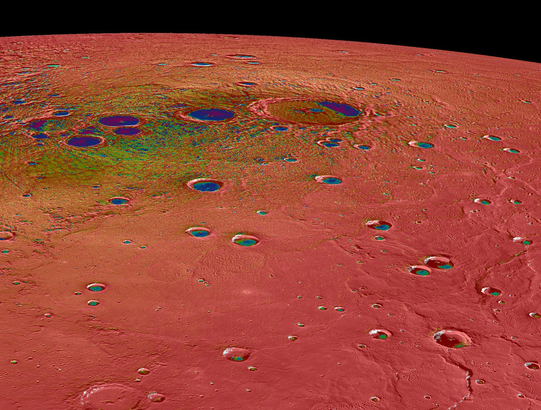
Enhanced-colour mosaics make subtle spectral differences easier to see. Different materials reflect light differently across the camera’s filters, and processing can amplify those contrasts. Orange or blue terrain in such a product should not be read as a literal description of what an astronaut’s eyes would see. [3]
Impact craters can expose material from below a plains surface. Comparing their ejecta with the surrounding ground helps reveal layers that would otherwise be hidden. Elevation data adds another constraint: a colour boundary and a ridge may correspond, but one should not assume a change in composition merely because the surface rises. [3]
Build a history from overlapping evidence
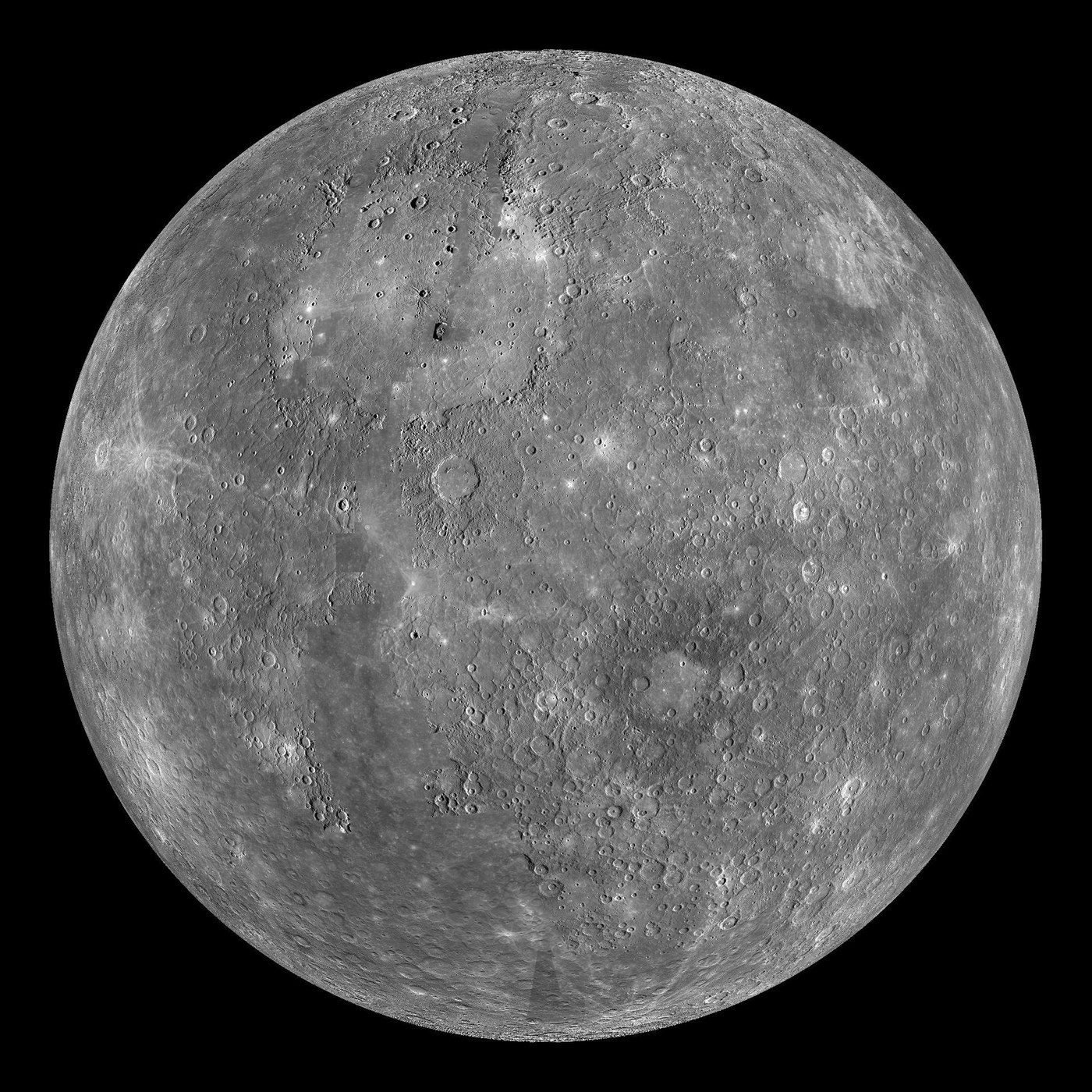
A useful reading of Caloris begins with the basin, then follows the plains that filled it, and finally the craters and fractures that cut those plains. Each observation answers a different part of the history. Images locate boundaries, stereo and laser measurements establish shape, and spectral data helps distinguish materials. [4] [3]
This method is useful far beyond Mercury. Planets preserve incomplete records, and later events erase earlier evidence unevenly. The task is to identify which relationships survive. Caloris offers a particularly large example of how a landscape can retain several episodes of change in one view, provided those episodes are read in the right order. [4] [3]
Sources & image credits
Related reading and objects
Why a day on Mercury lasts two years
MESSENGER mapped a world whose clocks disagree: one orbit takes about 88 Earth days, one rotation about 59, and sunrise to sunrise about 176. Those three numbers describe different motions. Reading the map means understanding which clock controls the sunlight.
How does water ice survive on Mercury?
In 1991, radar found unusually bright patches near Mercury’s poles. MESSENGER later connected them with polar deposits and permanently shadowed craters, explaining how water ice can survive so close to the Sun.